
工作方式How we work

每一步做什么,
谁来做
What happens,
and who does it.

从桌面研判到野外验证,以及 AI 与地质专家各自的边界。From desktop assessment to field verification — and where the limits of AI and geologists lie.

桌面阶段的真实难处The desk phase, honestly

找矿从来不缺数据,
缺的是把数据放到一起看
Exploration never lacks data. It lacks a way to see it all at once.

两百篇资料,人只能精读十几篇Two hundred sources, time to read a dozen

一个矿区真正相关的文献可能有两百多篇,分散在不同年代、机构、坐标系和语言里。不是专家不努力,是人力精读的上限就在那里。A single district can have two hundred relevant documents across decades, agencies, datums and languages. It isn't effort that runs out — it's reading capacity.

前人的结论,彼此打架Previous conclusions disagree

A 队和 B 队对成因、成矿时代、品位门槛的判断不一致,靠单一来源采信,很容易把方向带偏。Survey teams disagree on genesis, age of mineralisation and cut-off grades. Trusting a single source can quietly steer the whole program.

被判"无矿"的老区,可能只是门槛变了"Barren" may just mean an old cut-off

当年因品位未达商业门槛被放弃的区域,按今天的技术和经济条件重新评估,仍可能具备价值。Ground dropped decades ago for missing the commercial grade of its day can look different under today's technology and economics.

标准工作流程Standard workflow

3 个阶段,10 个步骤3 phases. 10 steps.

没有发明新的勘探方法——仍按矿产勘探的传统流程走,用 AI 把过去受限于人力、只能挑重点看的整合工作,做到人工难以达到的广度和一致性。No new exploration method was invented. We follow the conventional sequence and use AI to bring a breadth and consistency to data integration that manual work can't reach.

桌面阶段Desktop

核心能力Core capability
  1. 01项目接入Project intake矿区位置、矿种、矿权文件与既有资料Location, commodity, licence documents, existing data
  2. 02初步分析与资料采集First pass & data gathering给出概要与补充采集方向,多轮补充Overview and what else to collect, in several rounds
  3. 03深度分析与矛盾识别Deep analysis & conflicts区分前人资料中的一致观点与冲突观点Separate agreement from conflict in prior work
  4. 04遥感分析与证据层Remote sensing & evidence layersGeoFusion 构建不少于 10 类证据层GeoFusion builds at least 10 evidence layers
  5. 05综合集成Integration遥感成果回流,形成项目初期综合报告Remote sensing fed back into an initial integrated report

里程碑 A · 地质师携报告赴现场Milestone A · geologists take the report to site

野外阶段Field

协同Joint
  1. 06地质踏勘Reconnaissance采样、简易化探、记录蚀变与产状Sampling, simple geochem, alteration and attitudes
  2. 07潜力区收敛Narrowing down现场与遥感数据融合,精度依数据而定Field and remote data fused; precision follows data

里程碑 BMilestone B

深部阶段Subsurface

专业队伍主导Led by licensed teams
  1. 08物探 / 化探Geophysics / geochemistry电法、磁法、重力获取深部数据Electrical, magnetic, gravity surveys
  2. 09钻探与矿体定位Drilling多孔联合控矿,单孔不足为据Multiple holes; one hole proves little
  3. 10资源量估算Resource estimation须取样化验获得品位,由具备资质的团队完成Requires assays; done by qualified teams
持续迭代Iterative不是交一份报告就结束。采样、化验、物探、钻探的新结果回流后,重新研判、调整优先级,形成"分析—验证—反馈—再分析"的闭环。It doesn't end with a report. New sampling, assay, geophysical and drilling results flow back in, the analysis is re-run and priorities re-ranked: analyse, verify, feed back, repeat.
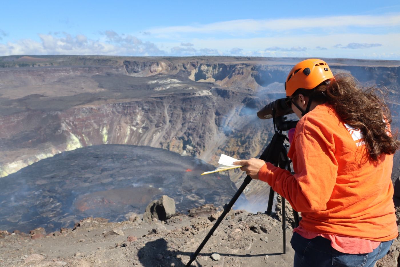
地质人员在野外观测

AI 与专家的分工AI and geologists

AI 负责看全,
专家负责拍板
AI sees everything.
Geologists decide.

AI 会漏判,也会误判,专家同样如此。AI 的价值是扩大可比较的信息范围、保留可追溯的证据、减少单一视角的偏差——不是天然比专家更准。每一次专家复核,都让系统更懂这一类矿。AI can miss and misjudge — so can experts. Its value is a wider evidence base, a traceable record and less single-viewpoint bias, not being inherently more accurate. Every expert review teaches the system more about that kind of deposit.

FIELD OBSERVATION · USGS
01

数据准确度识别Data quality screening

存疑数据先标注、加约束,明显错误的数据不进入研判。Questionable data is flagged and constrained; clearly wrong data is kept out.

02

资料分级Source grading

对矿区有直接参考作用的资料与间接参考资料分级使用、交叉比对。Directly and indirectly relevant sources are graded and cross-checked.

03

专家审定Expert review

专家审定报告框架、分析对象与证据取舍,并据实修正。Experts approve the framework, targets of analysis and which evidence counts.

04

现场核实Field check

AI 的结论建立在所给资料之上,专家会到现场核实资料与实际是否一致。Conclusions rest on the data given, so experts verify on site that records match reality.

我们提供What we provide

  • 多源资料整合、矛盾与证据缺口识别Multi-source integration; contradictions and evidence gaps
  • 可追溯的潜力区研判与风险提示Traceable prospective areas and risk flags
  • 下一步验证方向与工程部署建议Follow-up priorities and work-program recommendations
  • 中后期项目的独立桌面复核Independent desktop review of advanced projects

边界Limits

  • AI 或遥感不单独给出资源量、储量、项目价值或经济性结论AI or remote sensing alone never gives resources, reserves, value or economics
  • 遥感仅反映地表约 20–30 厘米,深部须依赖物探与钻探Remote sensing sees ~20–30 cm of surface; depth needs geophysics and drilling
  • 遥感不适用于所有矿种,不能作为排除潜力区的唯一依据Remote sensing doesn't suit every deposit and can't rule an area out alone
  • 有什么精度的数据,才有什么精度的成果;不承诺找矿结果Output precision follows data precision; no discovery is guaranteed

资料保密Confidentiality

每个矿区,一套独立的判据与资料One district. One isolated body of knowledge.

矿区资料只挂载在所属项目上,不进入模型权重。A district's data is attached only to its own project and never baked into model weights.

项目隔离Project isolation

每个矿区有专属的资料库与工作流,未经人工监督批准,项目之间数据不互通。Each district has its own data store and workflow; nothing crosses between projects without supervised approval.

敏感数据合规处理Sensitive data handled lawfully

涉及敏感地质、测绘或矿山数据时,采用数据隔离、本地化或离线处理方案,在授权范围内工作。Sensitive geological, survey or mine data is processed in isolated, localised or offline setups, strictly within the authorisation given.

不作公开案例Never a public case study

签署保密协议后接收资料。客户项目的事实、坐标与数据只用于该项目,项目关闭即冻结。Data is received under NDA. Client facts, coordinates and data serve that project only and are frozen when it closes.

主要矿种Commodities

Au金Gold
Cu铜Copper
Cr铬铁矿Chromite
Li锂Lithium

国内与海外项目均可承接。不同矿种流程框架一致,具体方法与指标存在差异。Projects in China and overseas. The workflow is the same across commodities; methods and thresholds differ.

适用阶段Where it helps

绿地 / 空白区Greenfields大面积资料少的区域,快速初筛、找到切入点Large, data-poor areas: fast screening to find a starting point
资料繁杂的项目Data-heavy projects多年积累、格式各异,整合研判并收敛验证方向Decades of mixed data, integrated into a focused testing order
中后期在钻项目Advanced drilling把未见矿钻孔一起纳入独立复核,由专家与既有报告逐项对比Independent review including barren holes, compared item by item with existing reports
已知矿脉之外Beyond known veins在现有成果基础上寻找新的解释方向和增量潜力区New interpretations and additional prospective areas around known mineralisation

从一个矿区开始Start with one district

ken@strikore.com

Try StrikOre

StrikOre 首版即将开放StrikOre opens soon

StrikOre 首版计划于 2026 年 12 月开放,以遥感为首个重点方向。想第一批试用,发邮件告诉我们你们的团队、项目阶段和矿种。The first release of StrikOre is planned for December 2026, leading with remote sensing. To be among the first users, email us your team, project stage and commodity.

PLANNED · 2026.12